OSM Rasterizer

Hello!! I want to introduce you to osm-rasterizer, a package that I’ve been meaning to publish for a while now (available here). It’s sole purpose is to take features from OpenStreetMap (OSM) and rasterize them into a tif file with a given resolution. This is useful if you want to use OSM data as labels for machine learning models.
The way it works is by creating layers of features that the user can choose from using the OSM tags. osm-rasterizer will query said tags for a specific bounding box and burn the features into an image. The user can decide whether all those features are one hot encoded or not, depending on preferences.
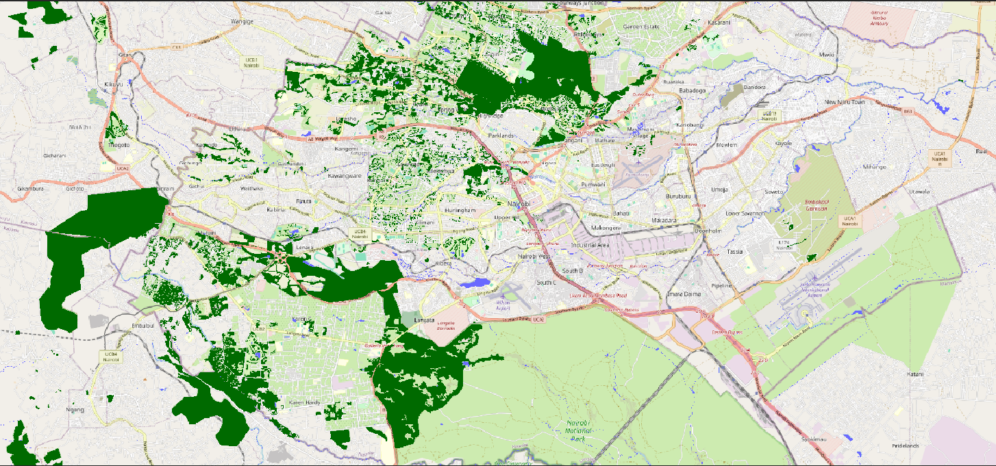
Most importantly, osm-rasterizer uses Overpass API to query OSM data by date, so the user can specify a point in time from which the data is to be queried. This is a useful feature if you want features from different time periods.
CLI Usage
This is an example of extracting water and forest features in a single layer in Nairobi, Kenya as a case study, if you add the --date flag, you will get the data for that particular date. The resulting image is in the projected UTM CRS for the bounding box.
osm-rasterizer
    --bbox "36.55363766400003,-1.442601803999969,37.06313313600007,-1.0646565169999689" \
    --feature 'water:{"natural": "water", "waterway": true, "landuse": "reservoir"}' \
    --feature 'forest:{"natural": "wood", "landuse": "forest"}' \
    --resolution 10 \
    --single-layer \
    # --date "2017-12-31" \
    --output nairobi_output.tif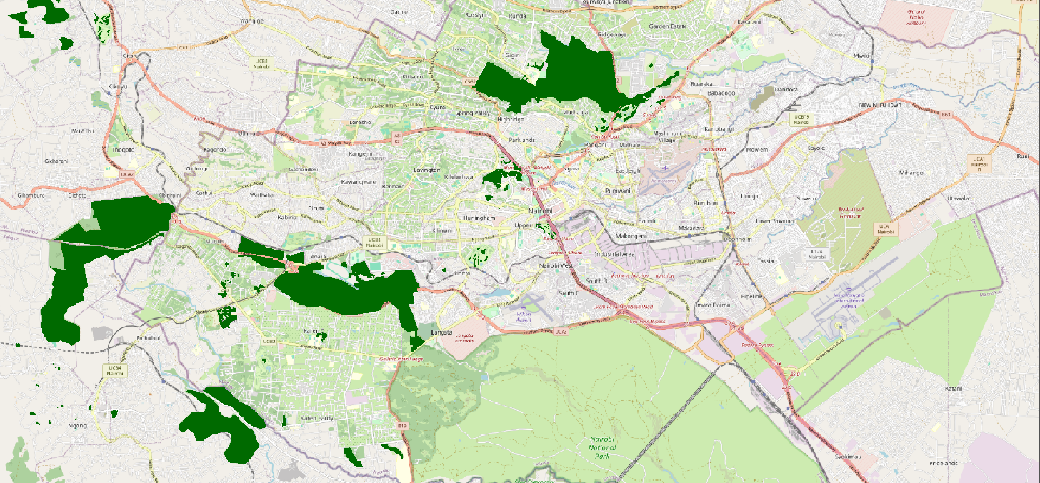
The package is still in development so if you find it useful or have any suggestions, please let me know!