3-30-300 Analysis in England
phd
cambridge
Investigating green inequality in the nation using advanced spatial analysis.
Overview
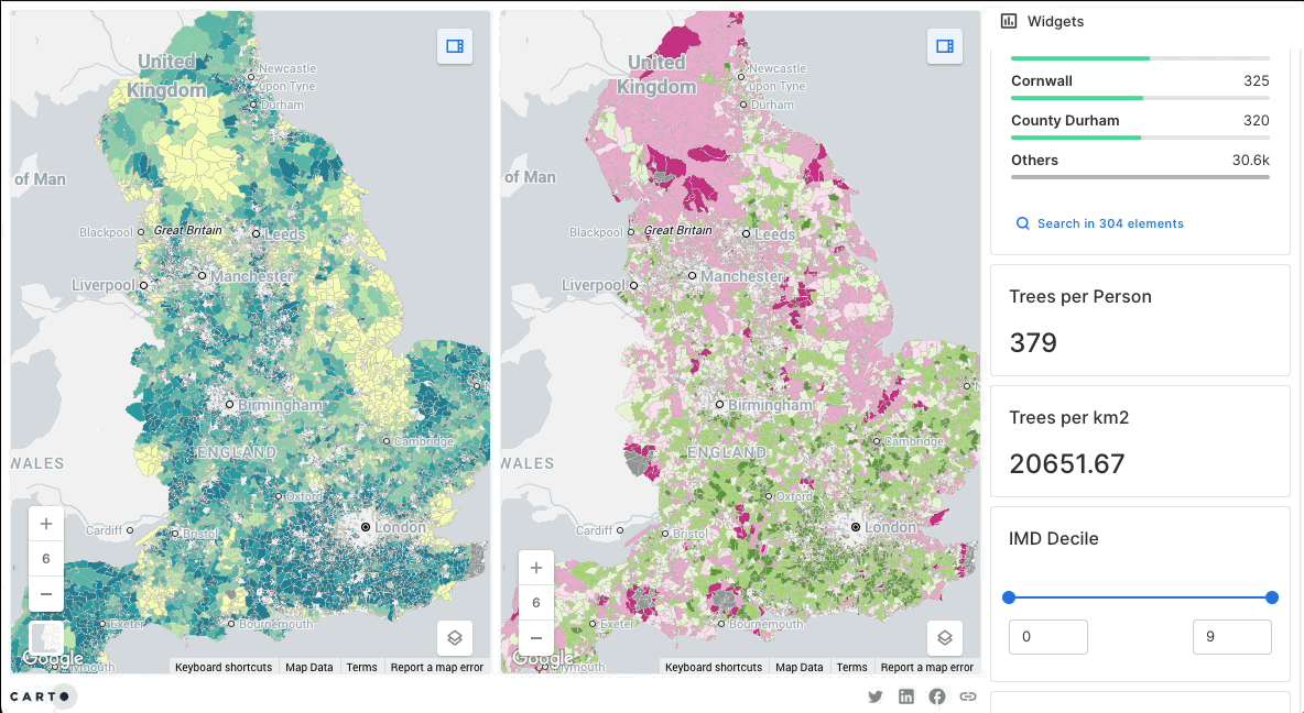
This is one of the big projects in my PhD in which I’m doing an extensive analysis of the 3-30-300 rule in all cities in England. To accomplish this, I’m using the Vegetation Object Model (VOM) to segment indivudal trees. Then using Ordnance Survey data and Verisk Buildings, I do a (very) big data analysis of how each building and output area fares in terms of 3-30-300 metrics. There’s a bunch of tools involved in this process, but the main ones are: Apache Sedona, Spark, NetworkX, and GeoPandas. Most plots in the paper were done in R. Would highly recommend reading the preprint