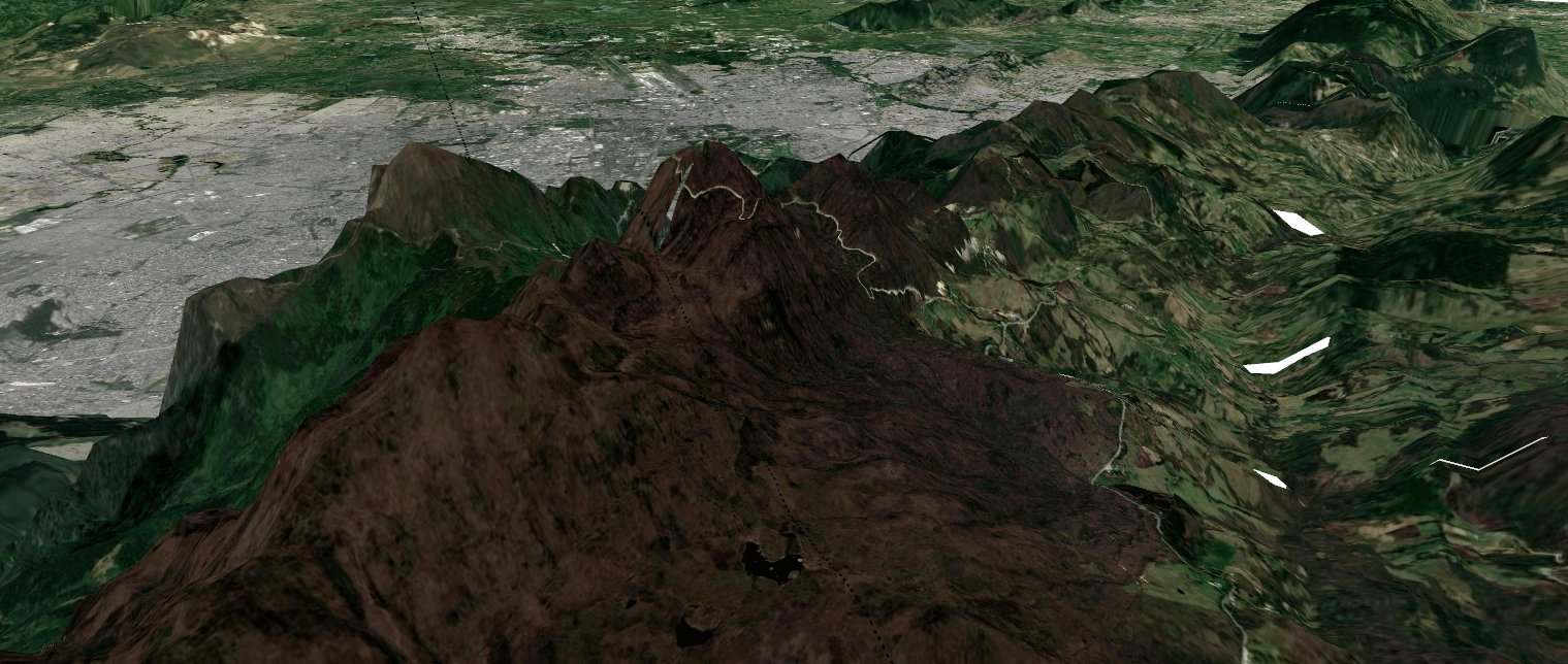
3D model of the Eastern Cordillera of Colombia
Visualization of the Cordillera viewed from the East near Bogotá
qgis
map
dataviz

As part of my Masters Thesis at Universidad de los Andes, where I wanted to understand past changes in the Eastern Cordillera de los Andes in Colombia, I worked in a páramo located near Bogotá, specifically, on the east side of the mountains. For my presentation and poster at AGU100, I created this 3D view of the study site using QGIS and DEM data available at Earth Explorer.
Visualization
Reuse
Citation
BibTeX citation:
@misc{c._zúñiga-gonzález2019,
  author = {C. Zúñiga-González, Andrés},
  title = {3D Model of the {Eastern} {Cordillera} of {Colombia}},
  date = {2019-12-03},
  url = {https://ancazugo.github.io/posts/2019-12-03-andes-3d-map.html},
  langid = {en}
}
For attribution, please cite this work as:
C. Zúñiga-González, Andrés. 2019. “3D Model of the Eastern
Cordillera of Colombia.” Andrés C. Zúñiga-González,
accepted, December 3. https://ancazugo.github.io/posts/2019-12-03-andes-3d-map.html.